.png)
Taking in Poipu Area Sights and Attractions
The sights and attractions around Poipu are so varied that visitors find something new to enjoy every day they set out to explore the area. Some attractions are close at hand while others are farther afield.
Spouting Horn

Poipu's famous Spouting Horn shoots geyser-like plumes of water into the air every dozen seconds or so. Incoming waves pass through an underground channel in the shoreline lava and then bursts skyward through a blowhole. A second hole most often simply moans and gurgles, but occasionally may erupt. The velocity of the main geyser is dependent on the tide and the force of the waves, so the higher the tide and the heavier the surf, the more spectacular the display.
Spouting Horn park includes restrooms, parking, drinking water, picnic tables, and an observation point with a safety fence.
Directions: Located along Lawa'i Road about two miles from the round-about
Smith's Tropical Paradise

Smith's Tropical Paradise
Smith's Tropical Paradise's 30-acre garden park is home to a variety of tropical fruits, forests of bamboo and palm trees, a Japanese-themed garden island, and Polynesian and Filipino huts. Wide paths meander through the garden and across occasional bridges. For a modest $10 per person ($5 for children), visitors can stroll through the shaded garden at their leisure.
Smith's Tropical Paradise
Directions: Smith's is located in Kapa'a, a short drive outside Poipu up Highway 56 north of Lihu'e. Smith's Tropical Paradise's unique offerings make it worth the little extra drive. Besides the garden, they offer a very popular luau and boat cruises along the gentle Wialua River.
Waterfalls

Opaeka'a Falls
Directions: Opaeka'a Falls can be viewed from an overlook off Kuamoo Road (Highway 580). The turnoff from Highway 56, north of Lihu'e, is the next intersection past Smith's Tropical Paradise. Be sure you are in the left lane well before the intersection. Drive about 2 miles to the overlook on your right. The twin falls drop 151 feet from a basalt and volcanic ledge on the Opaeka'a Stream
A fenced trail at the upper end of the overlook leads to a highway crossing and a wonderful view of the Wailua River far below.
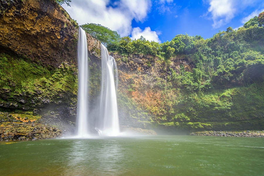
Wailua Falls
Wailua Falls are on the south fork of the Wailua River. For those who remember the old television program Fantasy Island, these are the falls shown each week in the opening of the show. The falls most often form two channels about 80 feet tall (not the 173 feet as some report). In times of heavy runoff after a storm, the water forms a solid, roaring cascade. Now and then a rainbow arcs over the falls, making a great picture.
Directions: The falls can be reached by turning onto Highway 583 from Highway 56 north of Lihu'e. A highway sign marks the turn. Drive about 15 minutes to the overview of the falls and a small, crowded parking area at the end of the highway. A trail to the bottom of the falls is steep and teacherous - not recommended.
Old Koloa Sugar Mill
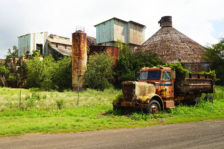
Old Koloa Sugar Mill
The Old Koloa Sugar Mill was part of the Ladd & Company Sugar Plantation, founded in 1835. Sugarcane had been grown on the Hawaiian Islands for hundreds of years before Ladd & Company opened this first large-scale plantation on the islands. After several attempts at other locations, in 1841 the company constructed a new mill near Koloa that would evolve into the historic mill shown here. Over the years the plantation and mill passed through many different owners until finally closing in 1996.

Old Koloa Sugar Mill
Today the mill is a National Historic Landmark. Every year the towns of Koloa and Poipu host the annual Kōloa Plantation Days Celebration, celebrating both the various ethnic groups that worked on the area's sugar plantations and also the island's Native Hawaiian population. The mill is part of Ka Ala Hele Waiwai Hooilina o Koloa, (Kōloa Heritage Trail), a 10-mile self-guided tour of the area's most important cultural, historical, and geological sites.
Directions: Reach the mill by driving out Mahaulepu Road from Koloa. View the mill from outside a protective fence.
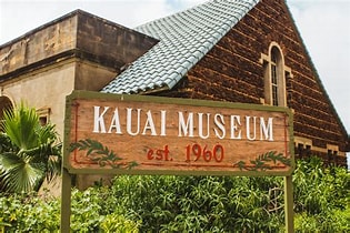
Kaua'i Museum
(courtesy Kauai Museum)
The Kaua'i Museum in Lihu'e is a great place to learn about Hawaiian history and culture. Exhibits include displays about the royal family of Kaua'i and the heritage of the Hawaiian people on Kaua'i. See displays of early tools, drums, gourds, shell leis, and much more. Weekly classes are offered in lei making, painting, and weaving. The Learning Center has new exhibits arriving soon. Already in place is an exhibit of Japanese emigration to Hawai'i. The gift shop features wonderful examples of Hawaiian art and crafts.
The Kaua'i Museum is open Monday through Friday from 9 AM to 4 PM, Saturdays from 9 AM to 2 PM. Tours are available.
Kaua'i Museum
Directions: The museum is at 4428 Rice Street in Lihu'e. Parking is easy in a lot beside the museum.
Allerton & McBryde Gardens

Allerton Garden
Allerton and McBryde Gardens are spread along a secluded valley, once part of the vast McBryde sugar cane plantation. The gardens feature a diverse collection of Hawaiian native plants and other rare specimens from around the world. The 50-acre property is open to guided or self-guided tours. Stroll along shaded pathways among a variety of palm trees, golden bamboo, towering rainforest trees, Plumeria, Bougainvillea, and hundreds of other exotic plants. Stop in front of the trees where scenes from Jurassic Park were filmed.
At the gardens' store and tour office, located outside the main gardens, find many interesting gifts, arrange your tour, and wander along paved pathways through a sample of the gardens. Restrooms are available.
Allerton-McBryde Gardens
Directions: Drive out Lawa'i Road from the round-about, heading toward the Spouting Horn. A short distance beyond the harbor, watch for the entrance to the gardens' tour office on your right. Ample free parking is available.
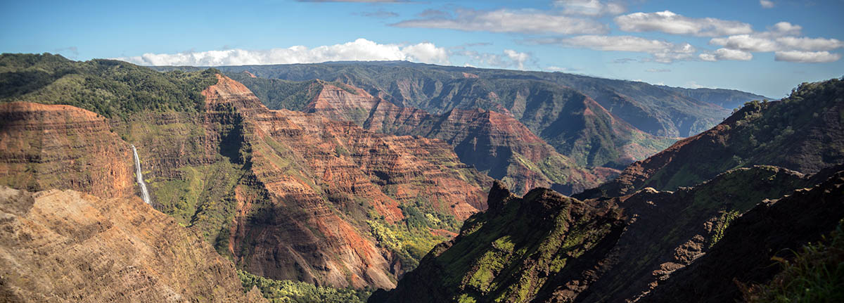
Waimea Canyon
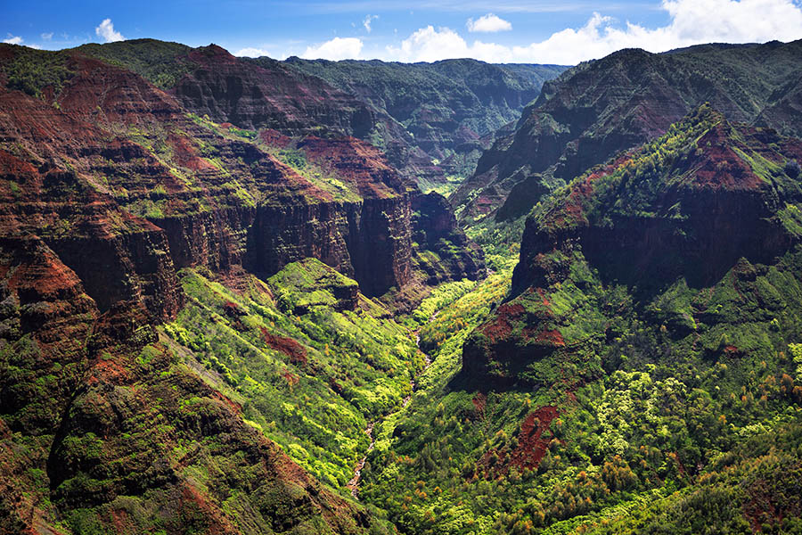
Waimea Canyon
Waimea Canyon is well outside Poipu, but worth the 27-mile drive from Koloa, especially if you arrive on a day with clear views of the canyon. The 14-mile-long gorge is more than a mile wide and 3,600 feet deep. Rugged canyon-sides and deep gorges form spectacular views from the several vista points along the road to the main Waimea Canyon Lookout.
Directions: From Koloa drive west on Highway 530 (Kaumualii Highway) to the town of Waimea. Then follow Highway 550 up the ridge, passing a number of lookouts along the way. Eventually reach the Waimea Canyon Lookout, about a 1-hour drive without stops.
Hanapepe Swinging Bridge

Hanapepe Swinging Bridge
The Hanapepe Swinging Bridge, a pedestrian suspension bridge, spans the Hanapepe River, connecting the town with private residences on the other side. The 186-foot bridge was built in the early 1900s, but suffered damage from hurricane Iniki in 1992. Although the bridge was restored and is safe to cross, it sways and tilts in ways that can be a little unnerving.
Directions: The entrance to the bridge is tucked away between buildings in the town of Hanapepe. Park along the main street and walk until you locate signs pointing the way. After crossing the bridge, return the same way and then spend some time enjoying the quaint town of Hanapepe.
Menehune Fish Pond
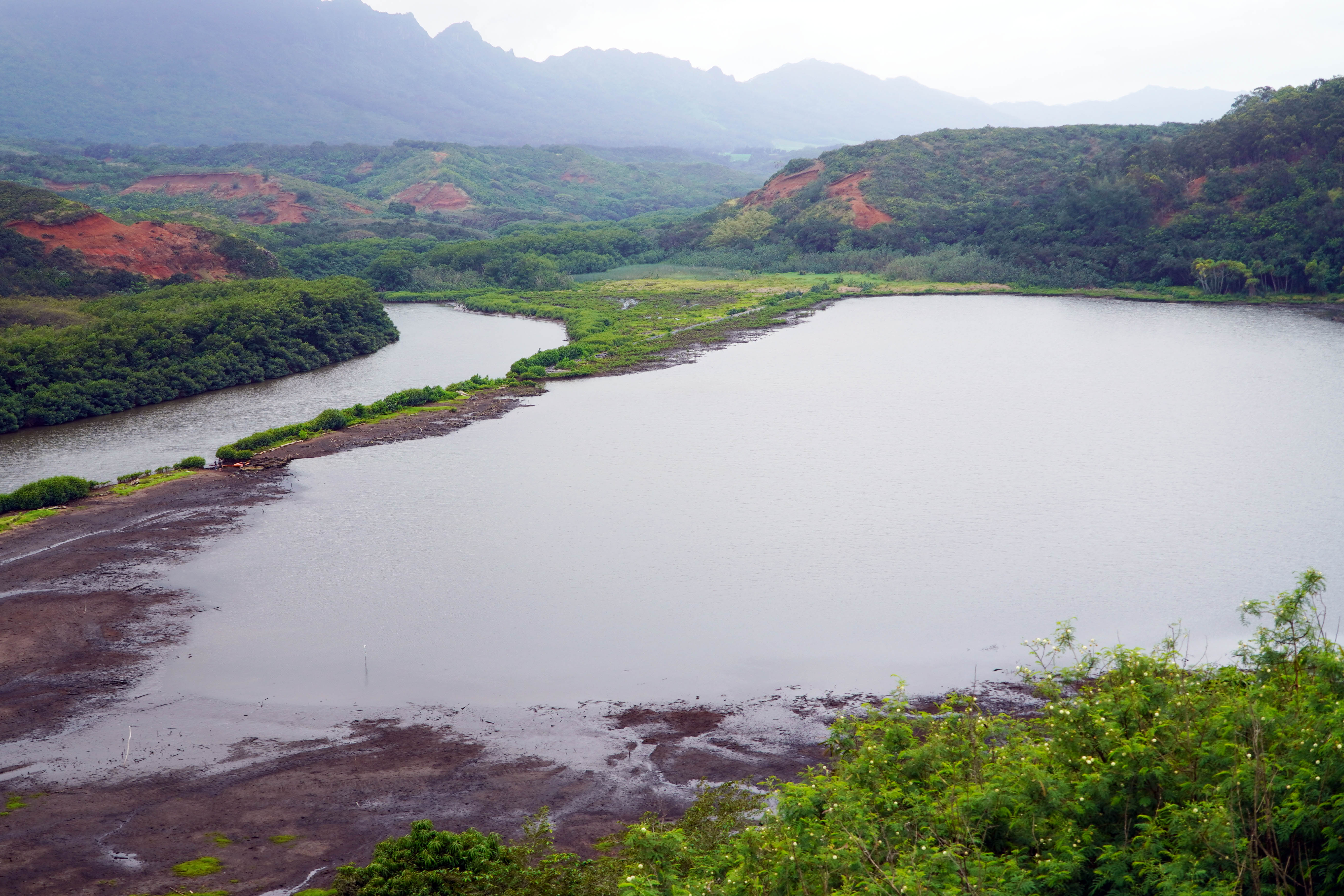
Menehune Fish Pond
Stop at an overlook along Hulemalu Road to view the Menehune 'Alekoko Fish Pond. Constructed nearly 1000 years ago by Hawaiians, the pond is an example of many such aquaculture ponds used to harvest fish. A 900-foot stone wall of lava rocks separates the pond from Hule'ia Stream. Sluice gates allow smaller fish to enter the pond, but as they grow they are prevented from leaving the pond.
Directions: One way to the fish pond overlook is to take Puhi Road off Highway 50 (across from Kaua'i Community College). Follow Puhi to its end and turn left on Hulemalu Road. A scenic approach to the overlook is to take the Kipu Road exit off Highway 50 as you approach the outskirts of Lihu'e from Koloa. The road changes names as in winds through the countryside, but eventually becomes Hulemalu Road near the fish pond overlook. Continuing on the road beyond the fish pond soon delivers you to Nawiliwili Harbor and then Lihu'e.
Koloa Heritage Trail
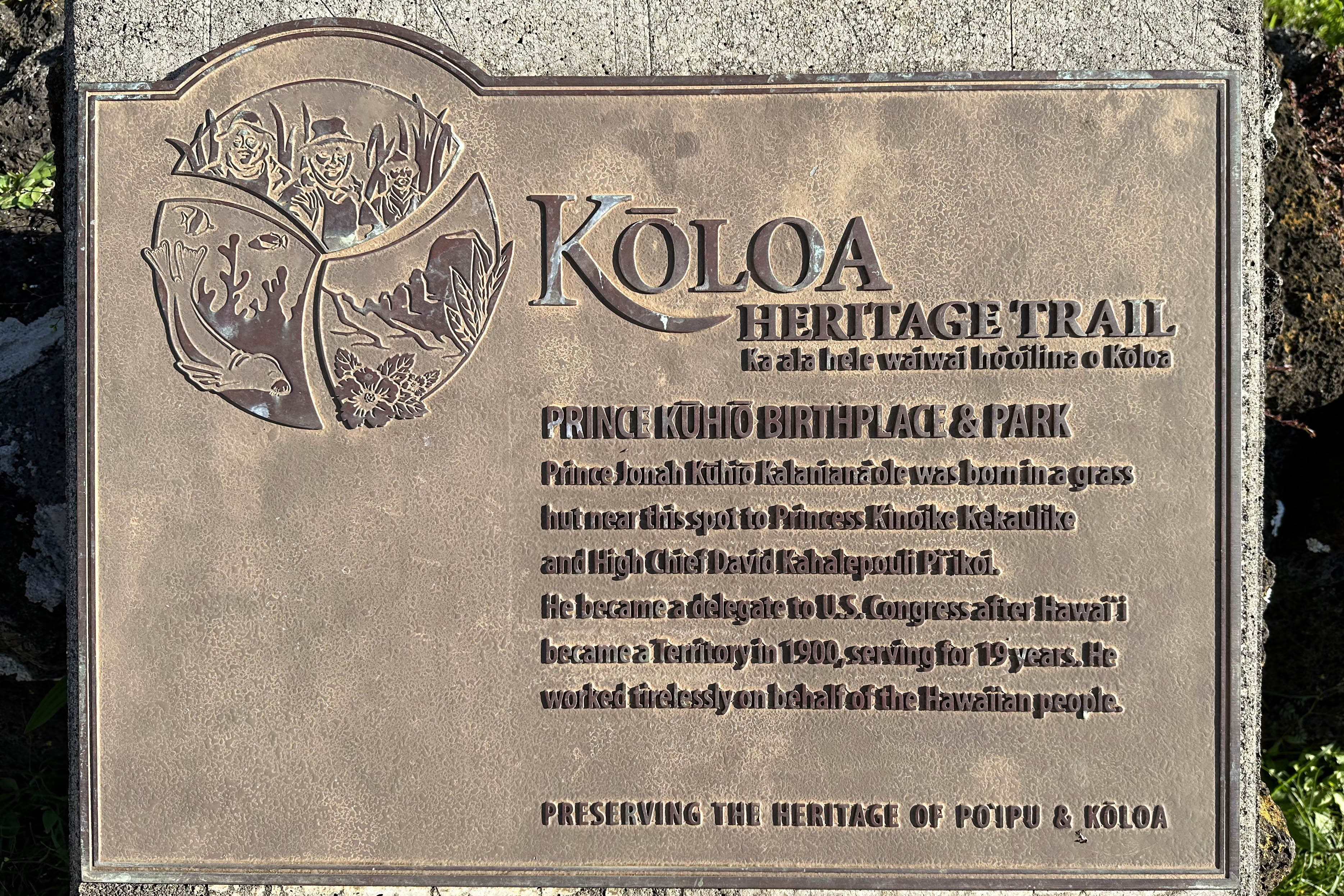
The Koloa Heritage Trail (also known as the Maha'ulepu Heritage Trail, the name given a nearby coastal hiking trail) covers 14 of the Poipu area's most important historic landmarks in a 10-mile, self-guided driving tour The landmarks along the driving tour are listed below:
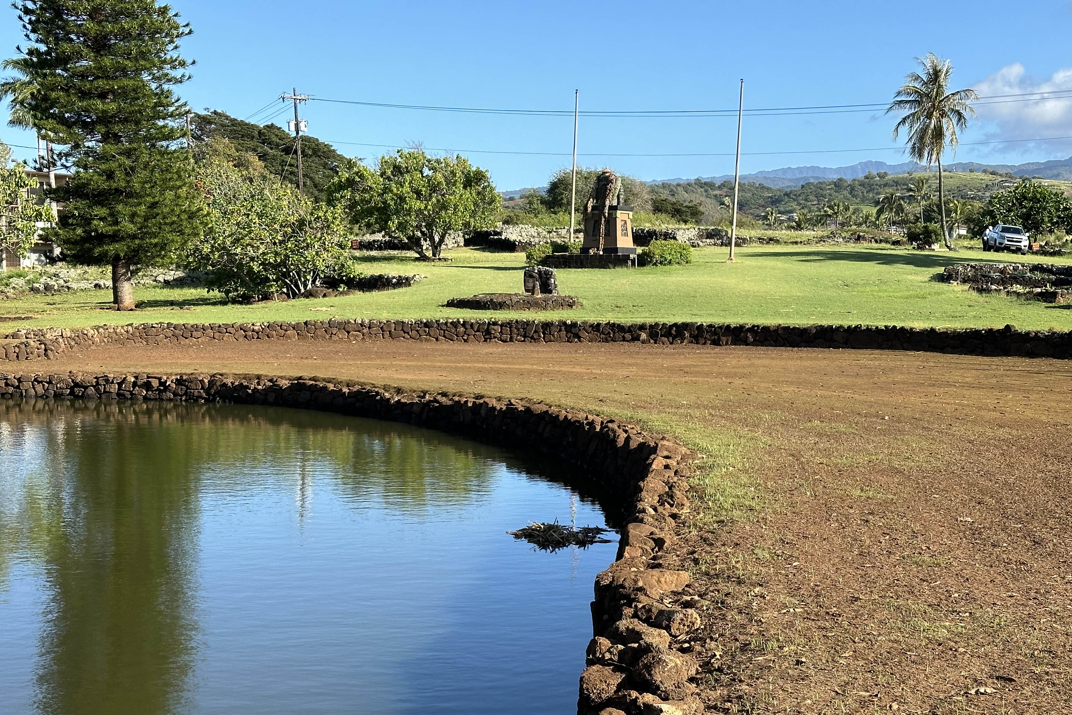
Prince Kuhio Park
- Prince Kuhio Park - Prince Kuhio was born here in 1871. He was a delegate to the United State Congress for 19 years, where he promoted the Hawaiian Homes Commission Act which preserved 200,000 acres of Hawaiian land for farms and homesites for people of Hawaiian descent.
Directions: The park is along Lawa'i Road. - Koloa Landing at Whaler's Cove on Hanaka'ape Bay was the center of whaling on Kaua'i from about 1820 to 1860. Dozens of ships lined up in the bay to take on supplies. Today the landing is used by divers and snorkelers.
Directions: Koloa Landing is at the bottom of a short spur off Hoonani Road - Moir Gardens was created by Alexandra Moir in the 1930s. The gardens are open to the public. The garden includes orchids, water lily ponds, cactus, and a magnificent monkey pod tree.
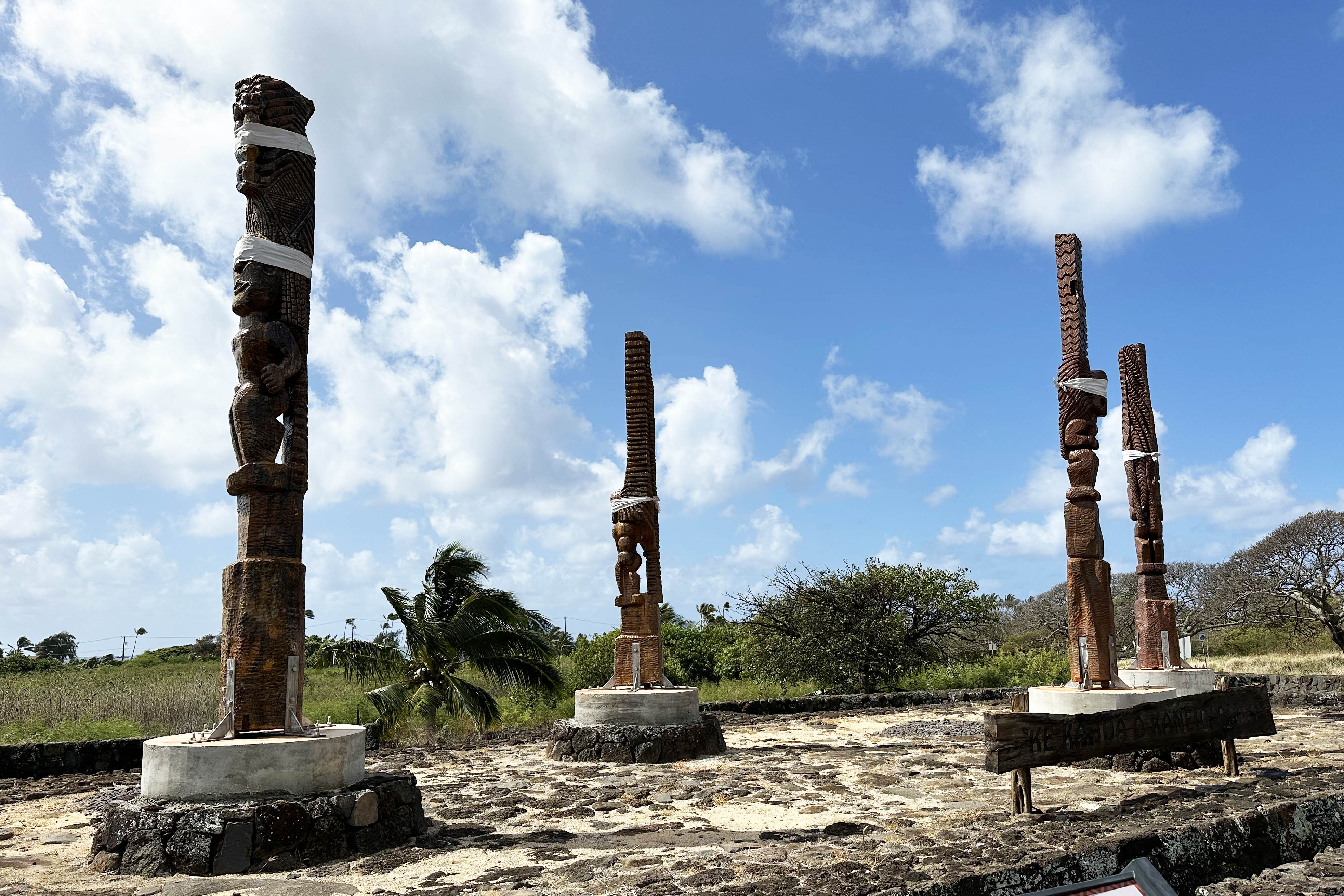
Directions: The gardens are located within the grounds of the Outrigger Kiahuna Plantation resort on Poipu Road. - Kaneiolauma, an ancient Hawaiian cultural site, was established in the mid-1400s. The site includes an ancient Hawaiian village, fishponds, irrigation systems, taro fields. Recognizing the significance of the site, in 2012 the County of Hawaii granted stewardship to Hui Malama O Kaneiolouma, a local non-profit cultural organization. Restoration has continued since then with goals of preserving, restoring, and sharing it with the public. Four 16-foot Ki'i statues standing on the corner of Poipu and Hoowili Road are representative of the Hawaiian gods. A viewing platform is now open to the public, but access to the grounds is not yet available.
Directions: The site is on the southeast corner at Poipu Road and Hoowili Road, inland from Poipu Beach Park. - Kihahouna Heiau is the site of an ancient, 130-foot by 60-foot temple; dedicated to Kāne, a major god of Hawai‘i, Hulokoki, a bird god, Kū-hai-moana and Ka-moho-ali‘i, two shark gods. Three hala-lihilihi-‘ula trees situated on the outside of the naupaka hedge mark the heiau perimeter.
Directions: A historic marker for the site is on the public beach walk at the Marriott Waiohai Beach Resort, on the western side of the property. - Shipwreck Beach was named for 100-foot+ wooden boat that was washed ashore and grounded at the water's edge. Over the years it was mostly covered by sand. Eventually the wreck was demolished by waves and by people stripping it for firewood. Shipwreck Beach spreads in front of the Grand Hyatt Hotel, east of Poipu Beach. The beach is the starting point of the Maha'ulepu Heritage foot trail.
- Makawehi and Pa'a Dunes were once mounds of sand, but over the centuries have turned mostly into limestone. A maze of trails leads over the dunes and connects to the shoreline trail to Mahaulepu Beach.
Directions: Approach the dunes from a small parking lot at the end of Ainako Street at Shipwreck Beach. - Pu'uwanawana Volcanic Cone is one of the youngest volcanic sites on the island. The small cinder cone is off Ala Kinoiki Road. A heritage plaque is on the east side of of the road. The volcanic cone is visible on the east side of Ala Kinoiki Road. Much of the cone is covered in vegetation.
- Hapa Road is believed to have been used by Hawaiians as long ago as 1200 AD. Today most of it is a narrow, paved road; the southern portion becomes a dirt road, often used as a foot and bicycle path.
Directions: The north end of the road intersects Weiliweli Road near where it becomes Mahaulepu Road.

Moir Gardens
Kiʻi Statues

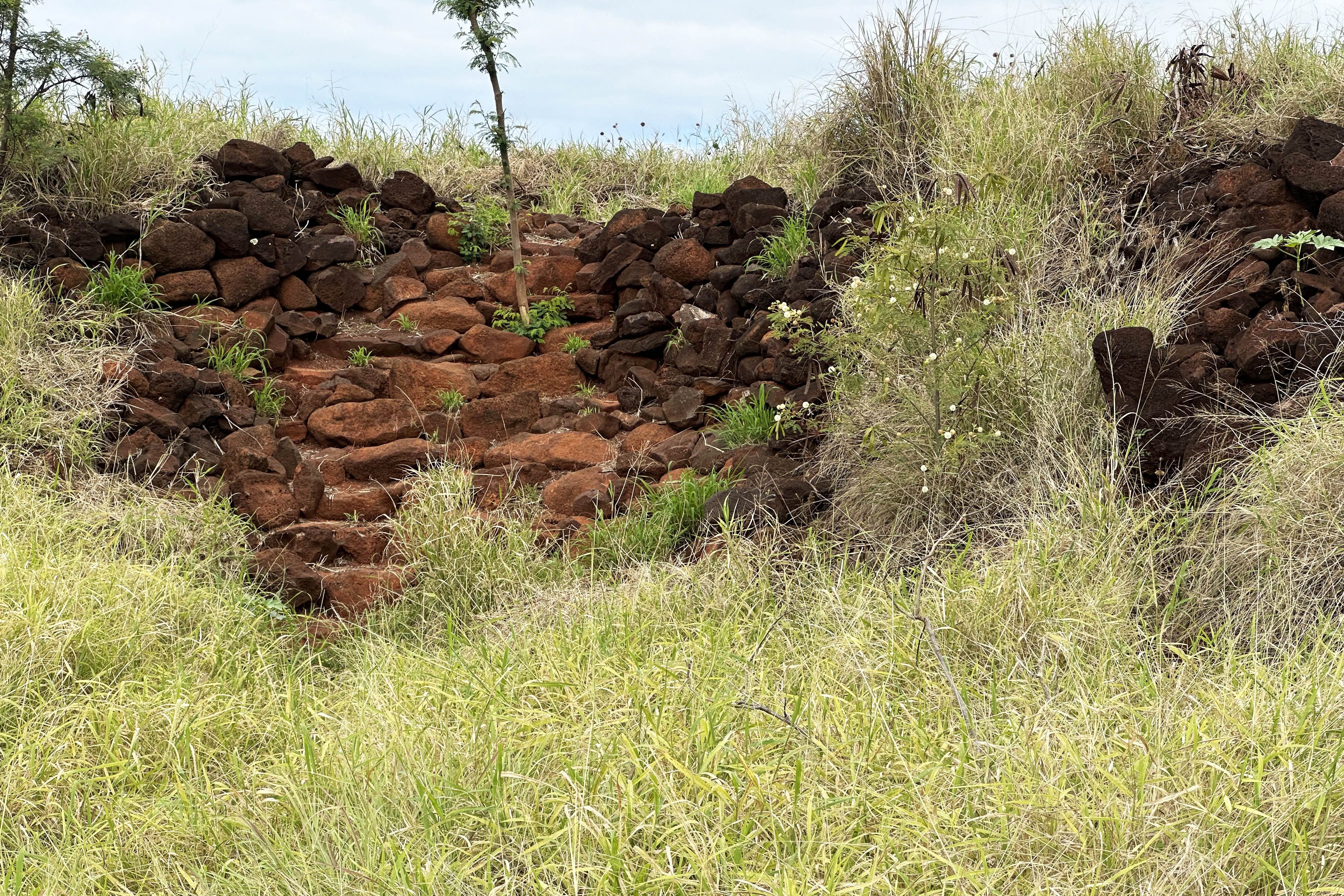
Pu'uwanawana Volcanic Cone
Russian Fort Elizabeth
Fort Elizabeth is a National Historic Landmark just southeast of Waimea. The fort is administered as the Pā'ula'ula State Historical Park. The fort was erected in 1817 by the Russian-American Company as the result of an alliance with High Chief Kaumualiʻi. The massive stone walls were constructed with local volcanic rock by Hawaiian workers following a Russian, star-shaped design. The fort overlooks the mouth of the Waimea River. Most of the walls are overgrown with vegetation, but a self-guided path leads into the interior of fort. Restrooms are available.
Fort Elizabeth
Directions: Follow Highway 50 toward Wiamea. As you near the town look for the sign to turn left into the fort parking lot: Pā'ula'ula State Historical Park